A powerful storm system is set to strike South Africa on Thursday, bringing disruptive rainfall, snow, damaging winds and excessive lightning across multiple provinces. The South African Weather Service issued the alert on Wednesday, warning that the severe weather pattern could disrupt transport, power supplies and daily routines for hundreds of thousands of residents.
Storm System Arrives Thursday
Meteorologists tracking the system confirmed that conditions will deteriorate rapidly from Thursday morning, with the most intense activity expected during afternoon hours. Cold air pushing in from the south will meet warm, moisture-laden air over the interior, creating the perfect conditions for violent thunderstorms and snow accumulation at higher elevations.
The weather service centre in Pretoria advised residents in the Highveld and surrounding regions to secure loose outdoor items and avoid unnecessary travel during the storm peak. Schools in some districts have already begun adjusting schedules, according to local media reports.
Snow Expected in Mountainous Areas
The South African Weather Service indicated that snowfall is likely across the Drakensberg mountain range and adjacent highland regions, with accumulations potentially reaching several centimetres in elevated passes. Motorists travelling theountain routes between KwaZulu-Natal and the Free State face the greatest risk of disruption.
Authorities in the Eastern Cape have begun pre-positioning emergency supplies along major highways. The provincial disaster management office confirmed it is monitoring the situation closely as temperatures drop.
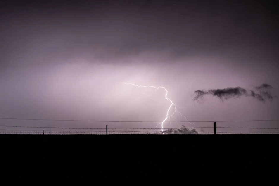
Lightning Strikes Pose Safety Risk
Excessive lightning activity accompanying the storm has prompted particular concern among safety officials. The national disaster management centre urged employers to consider flexible working arrangements where possible, reducing the number of people exposed during peak storm hours.
Power grid operator Eskom stated it has crews on standby across Gauteng and surrounding provinces following previous storm-related outages that left suburbs without electricity for extended periods. Local municipalities in the Vaal Triangle area have issued advisories asking residents to charge devices and prepare backup power sources.
Urban Areas Face Flooding Risk
City officials in Johannesburg and Pretoria warned that heavy rainfall over saturated catchments could overwhelm storm drainage systems, leading to flash flooding in low-lying suburbs. The Johannesburg Emergency Management Services confirmed it has increased personnel at known problem spots including the low-level bridges in the southern suburbs.
Residents in informal settlements across the Ekurhuleni metropolitan area face the highest vulnerability, with inadequate drainage and limited shelter options compounding the risk. Local non-governmental organisations have begun coordinating with the municipality to identify families requiring relocation during the storm.
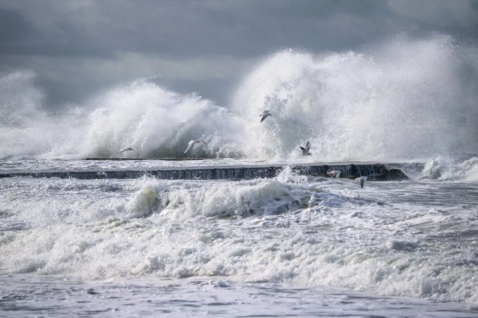
Coastal Regions Brace for Strong Winds
Coastal communities along the Eastern Cape and parts of KwaZulu-Natal will experience strong to gale-force winds as the system tracks eastward. The Port of Durban has indicated it may restrict vessel movements if conditions deteriorate beyond safe operating thresholds.
Fishing communities in the Pondoland area have been advised to secure vessels and delay any planned departures until the storm passes. Local fishing cooperative leaders confirmed they have communicated warnings through community networks and mobile phone groups.
What Residents Should Do Now
Emergency management officials recommend several practical steps before the storm arrives. Households should check that gutters and drainage channels are clear of debris, secure or remove any loose objects from gardens and balconies, and ensure emergency contact numbers for local disaster management units are saved and accessible.
Those living in flood-prone areas should identify alternative shelter options with family or community members on higher ground. Parents should confirm school communication channels are active and review any cancellation procedures their local schools have established.
Looking Ahead
The weather service is expected to issue updated bulletins throughout Thursday as the system develops. Meteorologists indicated the storm could clear by Friday morning, though residual effects including cold temperatures and localized flooding may persist through the weekend.
Residents should monitor official channels for the latest forecasts and be prepared to adjust plans at short notice. The next major update from the South African Weather Service is anticipated by Thursday afternoon, when the storm's exact track and intensity will become clearer.
See Also
- Morocco Tops Africa's Industrialisation Index — Seizes Aerospace Opportunity
- Kenya CEOs Warn: AI Gap Is Silencing African Workers
The Johannesburg Emergency Management Services confirmed it has increased personnel at known problem spots including the low-level bridges in the southern suburbs. The Port of Durban has indicated it may restrict vessel movements if conditions deteriorate beyond safe operating thresholds.
What is the latest news about south africa braces for severe storm snow lightning and heavy rain converge thursday?
Why does this matter for infrastructure-cities?
What are the key facts about south africa braces for severe storm snow lightning and heavy rain converge thursday?